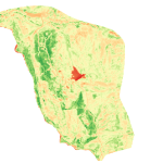
Foundational Site Intel
If you’re spending millions on a bunker, safe haven, or legacy estate, the biggest mistake you can make is skimping on the evidence. The Foundational Site Intel is your insurance policy against regret.
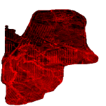
Sentinel Monitoring
Monthly strategic site surveillance, automated risk alerts (e.g. trail formations, soil instability), and peace of mind.
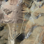
Strategic Intel
Strategic Intel delivers agile, customizable terrain intelligence for strategic, ad hoc, or expedient needs—on land or at sea.
Activate protection wherever and whenever you need it, with precision modeling, tactical relocation blueprints, and encrypted field reports - all tailored to your unique risk profile and operational tempo.
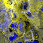
Existing asset Insights
Whether you’re safeguarding mobile operations, temporary installations, or high-value assets.Our blockchain-secured reports support confident daily decision-making, help you stay ahead of changing risks, and ensure your assets and operations remain protected—no matter what challenges arise.